Difference between revisions of "Template:Astoria Sidebar"
From OakthorneWiki
Jump to navigationJump to search (New page: <div style="float: right; width: 300px; border: 1px black solid; margin: 10px; padding: 10px;"> {| class="wikitable" style="margin: 1em auto 1em auto" | style="background:white; color:blac...) |
|||
| (14 intermediate revisions by the same user not shown) | |||
| Line 1: | Line 1: | ||
| − | |||
{| class="wikitable" style="margin: 1em auto 1em auto" | {| class="wikitable" style="margin: 1em auto 1em auto" | ||
| − | | style="background:white; color:black" | <div style="text-align: center; font-size: 180%"> | + | | style="background:white; color:black" | <div style="text-align: center; font-size: 180%">Astoria, Oregon</div> |
|- | |- | ||
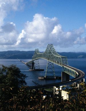
| − | |[[Image: | + | |[[Image:Astoria.jpg|300px|center]] |
|- | |- | ||
| − | | | + | |'''Country:''' United States<br>'''State:''' Oregon<br>'''County:''' Clatsop<br>'''Founded:''' 1811<br>'''Incorporated:''' 1876<br>'''Mayor:''' [[City_Center_Characters#City_Government|Aubrey Astor]]<br>'''ZIP Code:''' 97103<br>'''Area Code(s):''' 503 and 971<br>'''Website:''' [http://www.astoria.or.us/ City of Astoria] |
|- | |- | ||
| − | | | + | | style="background:lightblue; color:black" | <div style="text-align: center; font-size: 125%">'''Area'''</div> |
|- | |- | ||
| − | | | + | |'''Total:''' 10.11 sq mi (26.18 km2)<br>'''Land:''' 6.16 sq mi (15.95 km2)<br>'''Water:''' 3.95 sq mi (10.23 km2)<br>'''Elevation:''' 23ft (7m) |
|- | |- | ||
| − | | | + | | style="background:lightblue; color:black" | <div style="text-align: center; font-size: 125%">'''Population (2010)'''</div> |
|- | |- | ||
| − | | | + | |'''Total:''' 9,600<br>'''Density:''' 1,538.5/sq mi (594.0/km2)<br>'''Ethnicities:''' White (90%), Hispanic (5%), Black (1%), Asian (2%), Pacific Islander (1%), Other (15)<br>'''Ancestries:''' German (15%), Irish (12%), English (10%), Finnish (6%), Norwegian (6%), Scottish (6%)<br>'''Income:''' $33,000 per annum (household), $42,000 per annum (family), 16% below poverty line |
|- | |- | ||
| − | |''' | + | | style="background:lightblue; color:black" | <div style="text-align: center; font-size: 125%">'''City Layout'''</div> |
|- | |- | ||
| − | |''' | + | |'''Total:''' 10.11 sq mi (26.18 km2)<br>'''Land:''' 6.16 sq mi (15.95 km2)<br>'''Water:''' 3.95 sq mi (10.23 km2)<br>'''Elevation:''' 23ft (7m) |
| + | |- | ||
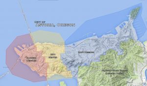
| + | |[[Image:AstoriaMap.jpg|300px|center]] | ||
| + | |- | ||
| + | |<div style="text-align: center; font-size: 125%">'''[https://mapsengine.google.com/map/edit?mid=z-373mfoBe00.kJfPsfMYYQnE Astoria GoogleMap]'''</div> | ||
| + | |- | ||
| + | | style="background:lightblue; color:black" | <div style="text-align: center; font-size: 125%">'''Neighborhoods'''</div> | ||
| + | |- | ||
| + | |'''[[Astoria City Center|City Center]]:''' ''(Low-Mid)'' [[Astoria Column]] • [[Bank of Astoria]] • [[Blue Ocean Thai]] • [[Crossroads Nightclub|Crossroads]] • [[Dollhouse|Dollhouse Hair Salon]] (and [[Warner's Loft]]) • [[Drina Daisy]] • [[Elaine's House]] • [[Kaffe]] • [[University of Astoria]] • [[Wet Dog Cafe]]<br> | ||
| + | '''[[Astoria Alameda WestLex|Alameda WestLex]]:''' ''(Mid)'' Old Ojala Cannery Warehouse • [[Youngs River Lofts]]<br> | ||
| + | '''[[Astoria Navy Heights|Navy Heights]]:''' ''(Low)'' [[Columbia Memorial Hospital]] • [[Stella's Home]]<br> | ||
| + | '''[[Astoria Cathlamet|Cathlamet]]:''' ''(Low)'' x<br> | ||
| + | '''[[Astoria Greenwood|Greenwood]]:''' (Mid-to-High)'' x<br> | ||
| + | '''[[Astoria Basin (CSF)]]:''' [[Bonfire Clearing]] • [[House of Running Water]] • [[Old Ranger Station]] | ||
|- | |- | ||
|} | |} | ||
| − | |||
Latest revision as of 16:47, 7 July 2015
Astoria, Oregon
|
| Country: United States State: Oregon County: Clatsop Founded: 1811 Incorporated: 1876 Mayor: Aubrey Astor ZIP Code: 97103 Area Code(s): 503 and 971 Website: City of Astoria |
Area
|
| Total: 10.11 sq mi (26.18 km2) Land: 6.16 sq mi (15.95 km2) Water: 3.95 sq mi (10.23 km2) Elevation: 23ft (7m) |
Population (2010)
|
| Total: 9,600 Density: 1,538.5/sq mi (594.0/km2) Ethnicities: White (90%), Hispanic (5%), Black (1%), Asian (2%), Pacific Islander (1%), Other (15) Ancestries: German (15%), Irish (12%), English (10%), Finnish (6%), Norwegian (6%), Scottish (6%) Income: $33,000 per annum (household), $42,000 per annum (family), 16% below poverty line |
City Layout
|
| Total: 10.11 sq mi (26.18 km2) Land: 6.16 sq mi (15.95 km2) Water: 3.95 sq mi (10.23 km2) Elevation: 23ft (7m) |
Neighborhoods
|
| City Center: (Low-Mid) Astoria Column • Bank of Astoria • Blue Ocean Thai • Crossroads • Dollhouse Hair Salon (and Warner's Loft) • Drina Daisy • Elaine's House • Kaffe • University of Astoria • Wet Dog Cafe Alameda WestLex: (Mid) Old Ojala Cannery Warehouse • Youngs River Lofts |

