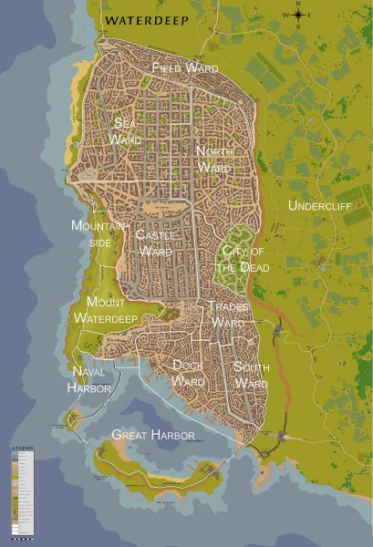
File:Map-waterdeep-sm-1491DR.jpg
From OakthorneWiki
Jump to navigationJump to search
Size of this preview: 409 × 600 pixels. Other resolution: 163 × 240 pixels.
Original file (1,376 × 2,018 pixels, file size: 636 KB, MIME type: image/jpeg)
File history
Click on a date/time to view the file as it appeared at that time.
| Date/Time | Thumbnail | Dimensions | User | Comment | |
|---|---|---|---|---|---|
| current | 12:01, 23 February 2019 |  | 1,376 × 2,018 (636 KB) | Oakthorne (talk | contribs) |
- You cannot overwrite this file.
File usage
The following 44 pages uses this file:
- 1354 DR History of Waterdeep
- Alleys of Waterdeep
- Blackstaff Tower
- Bright Vaeteru
- Businesses of Waterdeep
- Castle Ward of Waterdeep
- Central Street of the Singing Dolphin
- City Buildings of Waterdeep
- City of the Dead of Waterdeep
- Cliffride
- Dock Ward of Waterdeep
- Dusken Glade
- FR Layout Templates
- Festhalls of Waterdeep
- Gangs of Waterdeep
- Guildhalls of Waterdeep
- History of Waterdeep
- Jelzar's Stride
- Mountainside of Waterdeep
- Nightlife of Waterdeep
- North Diamond Street
- North Ship Street & South Snail Street
- North Ward of Waterdeep
- Northern Seawatch Street
- Northern Street of Silver
- Northern Swords Street
- Northwest Waymoot
- Old Temple
- Residences of Waterdeep
- Sea Ward of Waterdeep
- South Book Street & Trollcrook Alley
- South Copper Street
- South Ward of Waterdeep
- Southeast Dock Street
- Southern Castle Ward
- Southern Street of the Sword
- Temples of Waterdeep
- Trades Point North
- Trades Ward of Waterdeep
- Undercliff of Waterdeep
- Undermountain
- Waterdeep
- Waterdeep Goods and Services
- Template:WaterdeepGuide